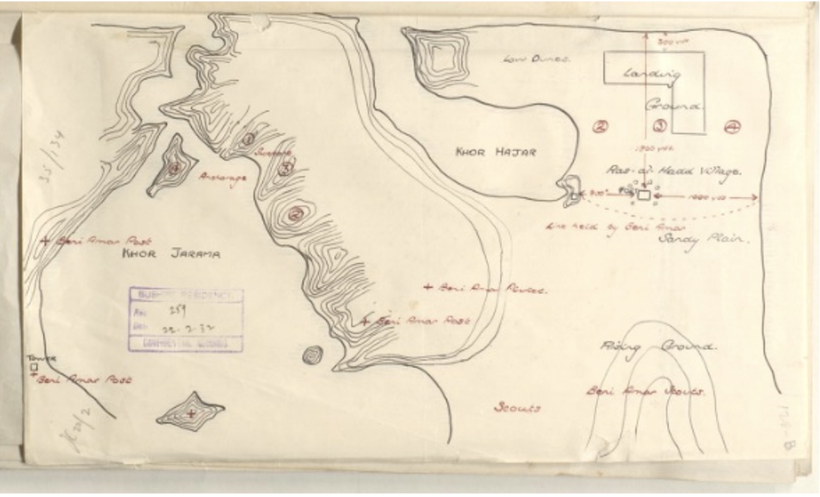
Cruising at sea. Course NE ½ N at 6 knots. Wind calm with blue sky. Barometer 29.90 inches rising to 29.96 at 0800 before falling to 29.93 at 1600 and finishing at midnight at 29.94 inches. Temperature at noon. 85F. 0430. Daylight Observed land NW. 0500. Altered course to NW. 0930. Mustered by divisions and read prayers. 1050. Stopped. Working engines as required. Boarded three dhows. 1145. Proceeded for anchorage of Khor Hajar.
Khor Hajar (Khor Hajar) is an inlet (class H – Hydrographic) in Al Mintaqah ash Sharqiyah (Ash Sharqiyah), Oman (Asia) with the region font code of Africa/Middle East…
Khor Hajar is also known as Khawr al Hajar, Khawr al Hajo, Khawr al Ḩajar, Khor Hajar, Khor al Hajr.
Its coordinates are 22°31’22” N and 59°46’31” E in DMS (Degrees Minutes Seconds) or 22.5228 and 59.7753 (in decimal degrees). Its UTM position is GK89 and its Joint Operation Graphics reference is NF40-08.
Noon. Wind NE force 1. Position 22.34N 59.45E. 1245. Stopped and came to in 16 fathoms and veered to 4 shackles. Anchorage bearings. W entrance to Khor Hajar S5W. Ras Hadd N86E. Magnetic. 1715. Mustered at Quarters. 1800. Detached cutter and whaler to exercise in company. Coal expended 9 tons 15 cwt. Number on sick list 14.