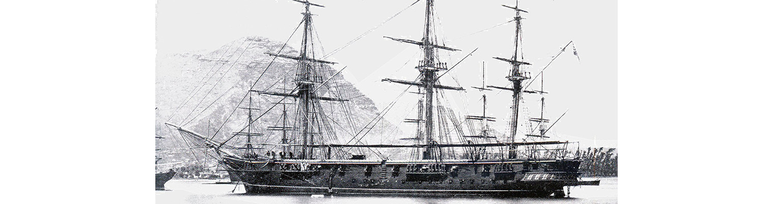
This is the story of the second ship to bear the name HMS Cossack.

Originally ordered by Russia for the Black Sea Fleet in December 1852 at a cost of 290,000 silver roubles, the ship was sold to the Hamburg trading house of Henry Mersk & Co. when relations between Britain and Russia deteriorated, as Russia feared possible confiscation.

The original contract price for the vessel, then named Witjas (Cossack), was £46,198, including £16,750 for machinery. The Admiralty subsequently paid the contractors £9,591 to complete the contract (of which £4,187 was for machinery), plus £751 for tonnage exceeding the specification and £2,206 for modifications for His Majesty’s service. The ship remained in service until 1875.

Year by Year

Discover the history of the HMS Cossack from 1854 to 1875.

You can search the ‘year’ and ‘month’ to find a specific date and also ‘click’ on the date itself to reveal any images and moments from that date.

15 August 1872

Wind ESE force 1 to 2 becoming east force 2.

Marines at drill. Released schooners TABO-SASO, NANORA and Cutter HER KLUT. Watering ship by launch

16 August 1872

Wind south easterly force 1 becoming ESE force 1.

Crossed upper yards and loosed sails.. Hauled out to a bow line. Exercised at General Quarters. Preparing for sea.

17 August 1872

Raised steam on starboard boiler.

0900 Weighed under steam and proceeded out of Levuka Harbour under steam and sail. As soon as clear of the reef stopped and made all plain sail.

1000. Shaped course SSE. Banked fires. Wind ESE force 1 becoming easterly force 1. Maximum temperature 82F. Sea temperature 79F.

Noon.  Makondranga – North. Mbatika N62E magnetic.

1600. High peak of Ovalau N24W. Angan north extreme N72E. In first reef of Topsails. Sent cutter away to board schooner which was the MARI…

Raised steam on starboard boiler.

0900 Weighed under steam and proceeded out of Levuka Harbour under steam and sail. As soon as clear of the reef stopped and made all plain sail.

1000. Shaped course SSE. Banked fires. Wind ESE force 1 becoming easterly force 1. Maximum temperature 82F. Sea temperature 79F.

Noon.  Makondranga – North. Mbatika N62E magnetic.

1600. High peak of Ovalau N24W. Angan north extreme N72E. In first reef of Topsails. Sent cutter away to board schooner which was the MARIAN BERNICE on the labour trade from  North Hebrides.

1800. Wakayia N4E. Mbatika N40E.

2000. Altered course to SSW ½ W. 2200. Vili on starboard beam.

18 August 1872

Latitude 17.52S. Longitude 178.51E. Wind easterly force 2 with rain becoming SE by E force 5. Under sail. Barometer 30.06 inches. Maximum temperature 75F. Sea temperature 80F.

0345. Ovalau SE by S. 0800. Altered course to S by W ½ W for anchorage.

1300. Shortened and furled sails and commenced steaming.

1330. Weather so thick with rain. Headed off NW wind having freshened suddenly to force 5 with heavy rain making it difficult to approach the land; not being able to discern the reefs and every …

Latitude 17.52S. Longitude 178.51E. Wind easterly force 2 with rain becoming SE by E force 5. Under sail. Barometer 30.06 inches. Maximum temperature 75F. Sea temperature 80F.

0345. Ovalau SE by S. 0800. Altered course to S by W ½ W for anchorage.

1300. Shortened and furled sails and commenced steaming.

1330. Weather so thick with rain. Headed off NW wind having freshened suddenly to force 5 with heavy rain making it difficult to approach the land; not being able to discern the reefs and every prospect of the weather lasting.

1420. Altered course to NNE ½ E. and made sail to double reefed Topsails, Courses and Top gallant sails. On Fore and main.

1530. Down Jib, in top gallant sails.

1715. Close reefed Topsails  and reefed Courses.

1900.  Altered course to NE ½ N. Weather thoroughly set in with heavy rain. Wind SE by E force 6 and squally with cloudy and threatening appearance. The barometer fell very little for at noon it showed 30.04 inches and at 1600 29.97 inches when it gradually rose. At midnight it read 30.05 inches.

19 August 1872

0700 Anchored of Levuka. . Wind south easterly force 3 decreasing to 2. Under steam and sail.

0030.Sighted Angau island E by N.

0100. Altered course to N by W.

0135.  Up Foresail and clewed up Main topsail.

0350. Sighted Mbatiki NE.

0410. Ovalau on port bow.

0500. Commenced steaming head to wind to wait for daylight. Levuka WSW. Proceeded for anchorage. Anchored with broken bottom in 15 fathoms and veered to 44 fathoms. Wind SE with squally rainy weather.

20 August 1872

Wind south easterly force 2  increasing to 3. Barometer 30.12 inches. Employed as most requisite. Sailmakers repairing water tank.

1600.  English barque METEOR arrived from Sydney – 12 days out.

21 August 1872

Wind ESE force 3 becoming north easterly force 3. Maximum temperature 81F.

0800. Crossed Top gallant yards and loosed sails. Sailmakers repairing Fore topsail.

1100. Furled sails. Sunset. Down Top gallant masts.

22 August 1872

Wind ESE  force 3 becoming north easterly force 3.

Employed as most requisite.

1700. Up Top gallant masts. Heavy continuous rain. Wind from SSE and squally.

23 August 1872

Wind easterly becoming ENE force 3.

Watch making gaskets etc. employed as most requisite.

24 August 1872

Wind easterly force 2. Barometer 30.18 inches. Maximum temperature 81F.

Employed cleaning ship throughout.

25 August 1872

Wind easterly force 2 decreasing to 1.

Performed Divine Service. Sent Roman Catholics to Chapel. Gave special leave to both watches.

26 August 1872

Wind easterly  becoming south easterly  force 2.

Shifted main topsails yard and jib boom. Sailmakers as requisite. Light easterly wind with passing showers.

27 August 1872

Wind easterly force 1. Barometer 30.10 inches

Crossed upper yards and loosed sails. Employed as requisite. Heavy rain all day with light airs from the eastward.

28 August 1872

Weighed and proceeded out under steam for target practice.

1325 Anchored off Levuka. Wind Light and variable  becoming easterly  force 1. A change in the weather for the better. Light SE by E wind. Lit fires under port boiler and proceeded at 100 to sea for target practice. Returning at  1330 to anchorage off Levuka in 14 fathoms and veered to 3 ½ shackles.

29 August 1872

Calm and light airs becoming westerly force 1.

Out boom boats. Mustered by Open List. Watering per launch.

30 August 1872

Wind SSW force 2 becoming southerly force 2. barometer 30.11 inches.  Maximum temperature 80F.

Exercised at General Quarters. Sailmakers repairing Fore topsail.

31 August 1872

Wind southerly force 2 becoming south easterly force 2.  Barometer 30.15 inches.

Employed cleaning ship and as most requisite.

Remarks

On our way from Tutuila to Tonga we had light SE winds although 2 to 3 days before our starting there was a fresh breeze from that direction and which we had hoped would last. A south westerly current set us about 15 miles per day for the first 2 or 3 days. Then as we got further south and nearer the Tonga group a slight north easterly current was felt. Tonga wo…

Wind southerly force 2 becoming south easterly force 2.  Barometer 30.15 inches.

Employed cleaning ship and as most requisite.

Remarks

On our way from Tutuila to Tonga we had light SE winds although 2 to 3 days before our starting there was a fresh breeze from that direction and which we had hoped would last. A south westerly current set us about 15 miles per day for the first 2 or 3 days. Then as we got further south and nearer the Tonga group a slight north easterly current was felt. Tonga would be difficult to make in bad weather on account of the lowest island of  Tongatabu; thought the first to be made  would be Eoa situated about ten miles from Tongatuba coast and about 250 feet high; tis island was seen long before we could make out anything else.  The channel between the reef and the islands on the starboard hand and the reef bordering the shores of Tongatabu was perfectly clear of danger and moreover our bearings in this case were correct for they always agreed with the chart and our position.

In entering the narrow part of the channel we immediately got in to a very strong tide forming a number of eddies. A pilot (native) here boarded and would persist in saying that the eastern side of the rock was the proper side to go, whereas we had intended to go the other side and which I believe was perfectly safe. (French VANDREUIL having used the same). The pilot was allowed after some time to take us up the eastern passage and proceeding on the bearings on the chart for the anchorage taking us for some purpose of his own round a circular reef off  Nakalofa (Nukualofa) instead of straight to town.

Our stay here was only two days during which we had fine weather and light easterly wind.

We left Tongatuba  by the northern passage under steam with light north easterly winds which we has expected to draw round to SE but instead veered round by the  northward on the fourth day out gradually hauling to the SW and eventually to SE with a fresh breeze. Sighted Turtle Island whose position agreed with chart and as we has that day very good sights  we were able to make use of the longitude. 

The weather up to the 17th August was fine with light south easterly winds occasionally veering to the NE . from then we had light easterly  winds sometimes freshening from the NE or SE accompanied with heavy continuous rain. The appearance of the weather generally very thick and a settled look of bad weather. Barometer generally very steady.

01 September 1872

Wind south force 3 becoming SSE force 2.

Performed Divine Service.

1500.  Fired and shotted guns as signal  to English Schooner AMERICA. Sent cutter to board and  remained all night. Heavy rain.

02 September 1872

Wind SE to ESE force 2. Maximum temperature 80F. Weather fine with light ESE wind.

Loosed sails to dry.

100. Furled sails. Employed as requisite.

03 September 1872

Wind northerly force 1increasing to 2.  Cloudy and showery all day.

Employed as requisite.

Hidden Gems

The Island of Kotka was attacked in 1855, but the garrison had already departed: barracks, stores and magazines etc were destroyed and the squadron left, leaving COSSACK in charge of the Island.

Anchor crest

Receive our newsletters?