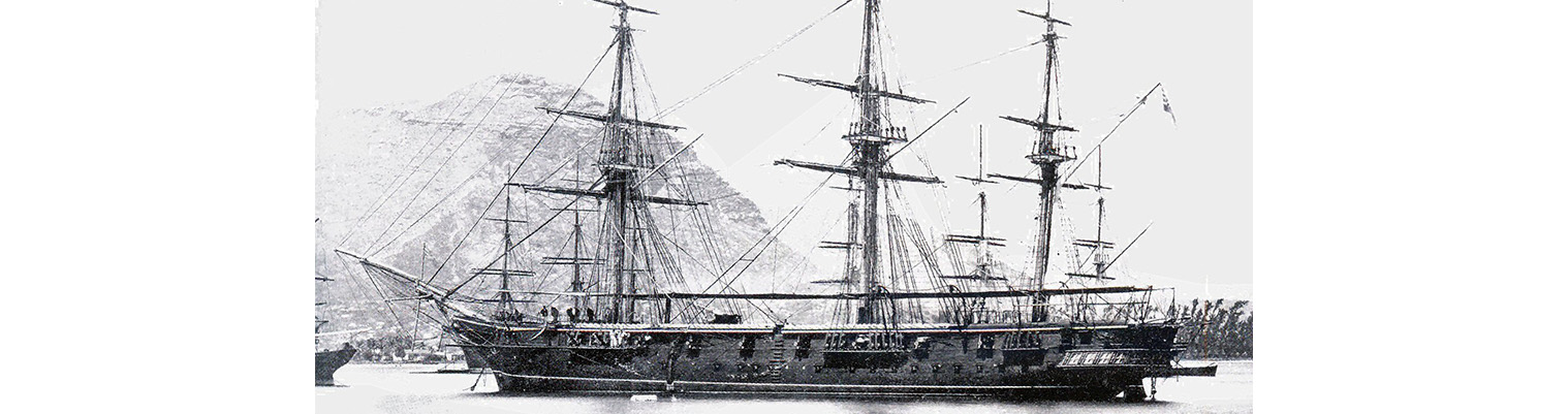
This is the story of the second ship to bear the name HMS Cossack.

Originally ordered by Russia for the Black Sea Fleet in December 1852 at a cost of 290,000 silver roubles, the ship was sold to the Hamburg trading house of Henry Mersk & Co. when relations between Britain and Russia deteriorated, as Russia feared possible confiscation.

The original contract price for the vessel, then named Witjas (Cossack), was £46,198, including £16,750 for machinery. The Admiralty subsequently paid the contractors £9,591 to complete the contract (of which £4,187 was for machinery), plus £751 for tonnage exceeding the specification and £2,206 for modifications for His Majesty’s service. The ship remained in service until 1875.

Year by Year

Discover the history of the HMS Cossack from 1854 to 1875.

You can search the ‘year’ and ‘month’ to find a specific date and also ‘click’ on the date itself to reveal any images and moments from that date.

06 July 1872

Wind east force 2 becoming south easterly force 1.

Painting ship and as requisite.

07 July 1872

Wind south easterly becoming ENE force 1.

Performed Divine Service and sent Roman Catholics to church.

1040. USS BASACA sailed.

08 July 1872

Calm. Maximum temperature 84F.

1950. French gunboat VANDREL sailed. Employed painting

09 July 1872

Wind north easterly force 2 becoming NNE force 2.

As requisite.

10 July 1872

Light and variable winds becoming NNW force 1.

As requisite.

11 July 1872

Wind north westerly force 2 becoming NNW force 1.

Sailmakers repairing main sail and as requisite.

12 July 1872

Wind calm becoming east force 2 decreasing to 1.

Completing water ring by launch. Employed as most requisite and repairing mainsail

13 July 1872

Wind east force 2. .

Completing water ring by launch. Employed as most requisite and repairing mainsail

14 July 1872

Wind ENE force 1 becoming NE force 2. Barometer 30.11. maximum temperature 88F.

Performed Divine Service. Gave leave to Ship’s Company.

15 July 1872

Wind north easterly becoming light and variable. Barometer 30.08 inches.

As most requisite and preparing for sea. In boom boats.

16 July 1872

Wind light south easterly becoming easterly force 1.

Crossed upper yards. Employed as requisite. Sunset. Down Topgallant yards.

17 July 1872

Wind variable force 1 becoming east force 1.

Crossed  upper yards. During  forenoon exercised at  firing shell at target. Sailmakers altering forecastle awning.

Sunset. down upper yards.

18 July 1872

Wind easterly force 1 becoming ENE force 2.

0630. Out boom boats. Crossed upper yards. Manned and armed boats. Exercised armed boats firing at taret with shot, shell and rockets.

1600. Down upper yards.

19 July 1872

Wind E by N force 2 becoming east and SE  force 2. Barometer 30.12 inches. Maximum temperature 84F.

Crossed upper yards. Employed as requisite. Unmoored ship. Weighed. ( sandy bottom). Shortened to 30 fathoms  broken bottom. In boom boats.


Remarks

Aphia. The natives are at present at war being divided into two parties called the small party who are for the young king ( The deceased King’s son) and the large party who represent other king (The deceased king’s brother). They are const…

Wind E by N force 2 becoming east and SE  force 2. Barometer 30.12 inches. Maximum temperature 84F.

Crossed upper yards. Employed as requisite. Unmoored ship. Weighed. ( sandy bottom). Shortened to 30 fathoms  broken bottom. In boom boats.


Remarks

Aphia. The natives are at present at war being divided into two parties called the small party who are for the young king ( The deceased King’s son) and the large party who represent other king (The deceased king’s brother). They are constantly having skirmishes and on Sunday 14th a regular engagement took place at about 1730pm over at East Point lasting for about an hour and in the end three heads were taken by each party and several wounded ( These were attended by our surgeons at the Mission House with Dr Turner of the Mission. This fighting of course tended to raise the cost of provisions. The chief trade being carried on Mr Webber (Prussian Consul) who had several ships trading between Hamburg and this place exporting the inside of coconuts (Cobra)  and importing dried goods and general stores.

The harbour, although small for sips swinging, is capable of holding several ships with a kedge out astern and moored with open hawse to eastward.  The western part of the harbour being suited for small vessels. There is no buoy as placed in the plan of the harbour. If the waterfall is seen and kept open to the east of the English Consulate it will lead in. No time of high water given at the Fr an Ch  we made it to be about 6 hours Fr and Ch. The rise and fall  not more than 6 feet

20 July 1872

Wind south easterly force 2 becoming ESE force 2.

0935. Left Apia Harbour under steam there being no wind but on reaching the offing we got a nice breeze from the eastward.

1100 Shaped course to NW by W ¾ W.

1610 Came to off  what we thought was Maataatu (Matautu?) but which turned out to be  Safooni Island about 40 westward of Mataatu. The name had evidently been printed by mistake in the wrong place. We thought that the outline of the reef did not appear the same as in the plan of Maataatu …

Wind south easterly force 2 becoming ESE force 2.

0935. Left Apia Harbour under steam there being no wind but on reaching the offing we got a nice breeze from the eastward.

1100 Shaped course to NW by W ¾ W.

1610 Came to off  what we thought was Maataatu (Matautu?) but which turned out to be  Safooni Island about 40 westward of Mataatu. The name had evidently been printed by mistake in the wrong place. We thought that the outline of the reef did not appear the same as in the plan of Maataatu on entering Safoone. We anchored for the night in 12 fathoms with the East Point N 50 E. White house ( native)  S30E. there was only a large village. Several natives came off with their goods.

21 July 1872

Wind ESE force 1 becoming easterly force 2.

0530. Weighed and stood east for Mataatu and at 0650 anchored in 10 fathoms with broken bottom. Anchorage bearings. North Point N84E. North of river S26W.

Performed Divine Service. The white people residing here are the missionary and the hands belonging to Mr Webber’s cocoa nut establishment. People seem to think that Safoone is the best harbour being more sheltered from the eastward.

The plan of Mataatu is certainly correct and the North Point is m…

Wind ESE force 1 becoming easterly force 2.

0530. Weighed and stood east for Mataatu and at 0650 anchored in 10 fathoms with broken bottom. Anchorage bearings. North Point N84E. North of river S26W.

Performed Divine Service. The white people residing here are the missionary and the hands belonging to Mr Webber’s cocoa nut establishment. People seem to think that Safoone is the best harbour being more sheltered from the eastward.

The plan of Mataatu is certainly correct and the North Point is made very conspicuous by the large red house and flagstaff with the German flag generally hoisted ( That belongs to Mr Webber) – also a low black rock rather like wharf shows very well against the white sand on either side. A little tot the right of this is a landing place or rather a place for boats landing. Here  the natives came off in great numbers with fowls and yarns etc which were exchanged for clothing. The middle aged appeared to be all over at Apia.

22 July 1872

Wind ESE force 2 becoming ESE force 3 to 4. Barometer 30.14 inches.

1700 Weighed and stood out of harbour under steam.

1715. Left Mataalu Bay for Pango-Pango (Pago –Pago). Shaped course E by S.

2200. Lost sight of Safoone

23 July 1872

Latitude 13.54S. longitude 170.55W. Course S12W. Under steam. Wind SE by E force 4.

0400. Opolu on starboard beam. Fore and aft sails set.

0420. Departed this life Mr S. Grindy. ( No reason given) .

0800. Altered course to SE. Sighted  two vessels standing into Apia.

Noon. Steaming  – steady SE wind. Tutuila in sight. Breeze S63E.

24 July 1872

Wind SE by E force 4 becoming easterly force 4. .

0200. Tacked and altered course to ENE.

1030 Anchored in Pango –Pango Harbour in 20 fathoms and veered to 3 ½ shackles. Anchorage bearings Goat island S85E. White House S12E


Remarks

On making the entrance to the harbour we found our position correct by the bearings. The different points being in general very clear and deserving of the names attached to them. Breakers Point forming the eastern side, no mistake could be made as the sea wa…

Wind SE by E force 4 becoming easterly force 4. .

0200. Tacked and altered course to ENE.

1030 Anchored in Pango –Pango Harbour in 20 fathoms and veered to 3 ½ shackles. Anchorage bearings Goat island S85E. White House S12E


Remarks

On making the entrance to the harbour we found our position correct by the bearings. The different points being in general very clear and deserving of the names attached to them. Breakers Point forming the eastern side, no mistake could be made as the sea was breaking well up on the point. The whale rock was scarcely breaking on our entering but on our leaving was breaking heavily with the heavy SE swell. The latter and the sunken rock are the only dangers. The harbour is large and would contain many vessels the only drawback being the amount of water for in the shallow water at the head of the harbour there is scarcely room to swing. Natives came off in great numbers with their goods to exchange them for old clothes. The American Government intend making this a coaling depot for their mail boats and have already commenced to call here dropping the mails in the agent’s boat who boards her outside.

25 July 1872

Wind NE force 1 becoming light airs before becoming SE force 3 to 4.

1700. Weighed and proceeded under steam to clear the harbour Left Pango-Pango Bay for Tongatapu (Tongtapu) Tonga. Made plain sail and shaped course south.

1900. Stopped steaming. Up screw.

Hidden Gems

The Island of Kotka was attacked in 1855, but the garrison had already departed: barracks, stores and magazines etc were destroyed and the squadron left, leaving COSSACK in charge of the Island.

Anchor crest

Receive our newsletters?