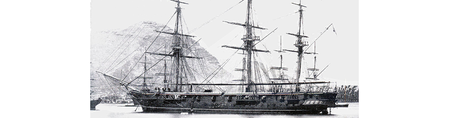
Year by Year
Discover the history of the HMS Cossack from 1854 to 1875.
You can search the ‘year’ and ‘month’ to find a specific date and also ‘click’ on the date itself to reveal any images and moments from that date.
18 June 1872
0600 Weighed under steam for Nanuku Passage. Wind northerly force 2 becoming NW force 2. Maximum temperature 84F. Made sail as requisite.
0800. Gora Island S55 W. South Point Taveuni north.
0830. Shaped course NE by E.
100. Sounded in 61 fathoms.
1430. Passed close to the assigned position of rock marked “dangerous” on chart 2691 and saw no sign of it. The chart appears very incorrect for several bearings placed her 6 or 12 miles out in some cases. On sighting Nanuka Island it showed two islands – the southern appearing to be the largest.
1600. Cap Island south ; Naitamba S66E.
1650. Course NE. 1715. Course NE by N.
1735. Course NNE.. Strong current setting to southward through Nanuka Passage..
1745.Sighted the northern most island on the eastern side.
1800. Nanuka Island W by N ½ N. passed through passage.
2200. Stopped steaming and made sail. Course NE.
Midnight. wind SSW force 4. The Island of Nanuka appeared to be laid down towards the eastward and the reef off Yalangalala more to the northward.
24 June 1872
Latitude 14.59S. Longitude 172.23W. Course S82E. Wind NNE force 2 becoming light and variable airs before becoming ESE force 4. Under sail.
During the night light NNE wind with lightning from NW and towards 0700 heavy bank came up in that quarter forming a complete arch from NW round to SW and which was evidently travelling fast and gradually freshening as it rose. Kept ship to her course NE by E. Shortened sail to Topsails and Courses.
0800. Squalls struck with sharp heavy rain. Close reefed Topsails. Up Courses. The wind freshened to about force 6 to 7 with scarcely any sea which showed that the wind did not extend very far and in fact was no sooner on us than it veered round on the starboard quarter. By 1000 the wind was at south and inclined to veer to the eastward. Made sail to Topsails and Courses. During the rest of the day the wind gradually veered to to NNE and consequently backing off to NW.
25 June 1872
Latitude 13.58S. Longitude 172.23. course N15E. Light airs becoming NNW force 4 changing to North 4 and then NNW force 1. Under sail. Wind fill light and at daybreak a light breeze sprang up from NW.
0700. Observed the Island of Savau (Somoa) to NW ½ W – distance 34 miles.
0930. Commenced steaming, wind WNW force 3, wishing to save our daylight.
1100 Sighted Manano Island and Apolima and Uprolin.
Noon. Shortened and furled sails having completely lost the wind being to leeward of Savau. South Point of Savau N57W. Course NNE. A most remarkable sight was the spouts of water on the east of Savau arising from the holes in the rocks and the washing of the sea. The steep island of Apoloma was NE 14 miles at noon.
1330. Were abreast of the island bearing ESE. Altered course to NE by N. The wind which had been easterly at 1200 now shifted to north force 3 to 4.
Remarks
On the north side of Apolima there is an opening to the centre by a small channel through the reef. Several natives were seen here. The island of Manano appeared to be connected to Upolu by reefs. The bearing along the coast appeared to agree pretty well and by keeping 2 to 3 miles off the reef there appeared to be nothing in the way. The Prussian flagstaff and the church steeple showed out very plainly over the low point. 1700. Observed an American corvette standing in. Pilot came out but did not require his services. 1745. Came to in 7 fathoms with sandy bottom and veered to 5 ½ shackles. Moored ship with 3 shackles on each cable. Anchorage bearings ; church SW ½ W. Point E by N. On mooring swivel. The American corvette stood off during the night. The harbour is well defined by the buffs. The waterfall mentioned in the Directions cannot be seen at the distance named for it was certainly not very easy to make out. Found here three Prussian vessels and L.M. Barque ??? Williams.
