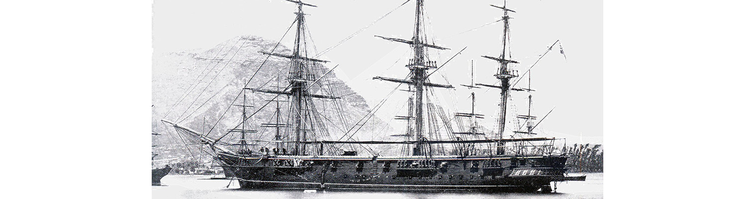
This is the story of the second ship to bear the name HMS Cossack.

Originally ordered by Russia for the Black Sea Fleet in December 1852 at a cost of 290,000 silver roubles, the ship was sold to the Hamburg trading house of Henry Mersk & Co. when relations between Britain and Russia deteriorated, as Russia feared possible confiscation.

The original contract price for the vessel, then named Witjas (Cossack), was £46,198, including £16,750 for machinery. The Admiralty subsequently paid the contractors £9,591 to complete the contract (of which £4,187 was for machinery), plus £751 for tonnage exceeding the specification and £2,206 for modifications for His Majesty’s service. The ship remained in service until 1875.

Year by Year

Discover the history of the HMS Cossack from 1854 to 1875.

You can search the ‘year’ and ‘month’ to find a specific date and also ‘click’ on the date itself to reveal any images and moments from that date.

17 April 1872

Wind westerly force 1 becoming east force .

Transported guns forward. Sent divers down to examine rudder.

18 April 1872

1730 left Farm Cove under steam for Figi (Fiji) Islands. Wind calm becoming NE force 1 and later east force 2. Balls Pyramid ( Lord Howe Islands) N69E 362 nautical miles. Sea temperature 70F. Crossed Royal yards. In boom boats. Preparing for sea.

1540 Lit fires under starboard boiler.
1730. Slipped from moorings and proceeded out of Port Jackson. Wind ESE .
1900. Shaped course ENE.
2000. Outer South head light SW. 2230 Lost sight of Inner South Head Light. During our stay we had chiefly westerly…

1730 left Farm Cove under steam for Figi (Fiji) Islands. Wind calm becoming NE force 1 and later east force 2. Balls Pyramid ( Lord Howe Islands) N69E 362 nautical miles. Sea temperature 70F. Crossed Royal yards. In boom boats. Preparing for sea.

1540 Lit fires under starboard boiler.
1730. Slipped from moorings and proceeded out of Port Jackson. Wind ESE .
1900. Shaped course ENE.
2000. Outer South head light SW. 2230 Lost sight of Inner South Head Light. During our stay we had chiefly westerly and southerly winds. The former being the strongest and bringing fine weather. The latter generally with heavy cloudy weather and rain for several hours together and several days of calms and light and variables

19 April 1872

Latitude 33.53S. Longitude 162.38E. Course S88E. wind SE by E force 2 becoming SE force 2. Under sail.

0115. lost sight of outer South head light –West.

0815. Made plain sail and stopped steaming. Altered course to NE by E. Windslight from SE. Up screw. Stowed guns and unbent cables.

Midnight. Wind fell very light

20 April 1872

Latitude 33.14S. Longitude 152.37. Course North. Wind light airs from the SE becoming NE force 2.

Under sail. Barometer 30.37 inches. Maximum temperature 72F. Light airs from south eastward and westward until 2100. Light breeze sprang up from NE by E. Tacked.

1440. Observed land bearing NW at sunset.

21 April 1872

Latitude 32.49S. Longitude 154.1. Course N70E. Wind NNW force 3 becoming SW force 2 and later SSE force 4. Barometer 30.12 inches and steady. Under sail.

Performed Divine Service. Altered course to N by ½ E. Wind gradually hauled round NNE to west and SSE. Freshening. In second reef of Top sails. Down Royal Yards. Strong lightning to southward. Working to Ball’s Pyramid.

22 April 1872

Latitude 32.6S. Longitude 156.40E. Course N72E. Wind southerly force 3 becoming NW force 2. Barometer 30.07 inches Under sail.

0300. Wind falling light from SE. Out reefs. Daylight.  Observed sail bearing Sw. Wind at 0400 backed round to south.

Noon. Wind SW. Light airs from westward and as far as NW at 2000. Again veering and freshening from the westward and WSW.

Noon. Altered course to ENE. Passed an American bark (barque). Barometer falling slightly.

Midnight 29.24 inches

23 April 1872

Latitude 31.32S. Longitude 159.32E. Course N77E. Wind south westerly force 5 becoming SW force 4. Barometer 29.88 inches  Under sail.

0540. Sighted Lord Howell Island E by N. altered course to east. Wind freshened to a strong breeze. ( 6 to 7). In second reefs of Topsails and reefs of courses.

0645. Saw Ball’s Pyramid E by S.

0700. Ball’s Pyramid S80E. Mount Ganer (?)  N55E.

0800 Ball’s Pyramid S78E. Ganer Point N10W. Passed between island and rock between 0730 and 0800. Very heavy sea o…

Latitude 31.32S. Longitude 159.32E. Course N77E. Wind south westerly force 5 becoming SW force 4. Barometer 29.88 inches  Under sail.

0540. Sighted Lord Howell Island E by N. altered course to east. Wind freshened to a strong breeze. ( 6 to 7). In second reefs of Topsails and reefs of courses.

0645. Saw Ball’s Pyramid E by S.

0700. Ball’s Pyramid S80E. Mount Ganer (?)  N55E.

0800 Ball’s Pyramid S78E. Ganer Point N10W. Passed between island and rock between 0730 and 0800. Very heavy sea over bank ( 40 fathoms). Ship running causing her to roll very heavily.  Maximum roll 40  degrees. SSW ¾ W. Lord Howells Island W by S ½ S. during forenoon wind SW force 4 to 5. Squally and heavy passing showers. Barometer which had hardly fallen all day yesterday continued to do so until 0800 when it was at 29.88 inches. ( At noon of yesterday it was 30.05 inches) and at noon was 29.90 inches and shortly rose to 29.97 inches. Weather cleared up during afternoon, wind steady.

24 April 1872

Latitude 30.23S. Longitude 162.1E. Course N62E.Wind SW force 3.

Under sail. Course NE ½ E steering to pass to northward of Norfolk Island. Steady south westerly wind force 3. Fine weather. Reefed Topsails and Royals.

25 April 1872

Latitude 29.32S. Longitude 163.58E. Course N63E. wind WSW force3 decreasing to 2.

Under sail. Maximum temperature 73F. Sea temperature 74F. wind SW to WSW gradually falling light and at 2000 had lightening from north westward.

26 April 1872

Latitude 28.56S. Longitude 165.35E. Course N67E.Wind north force 3 decreasing to 2 and becoming north westerly force 3 later. Barometer 30.00.

Under sail. Maximum temperature 71F. Wind northerly between NW and NNE with squally weather  and heavy rain accompanied with thunder and lightening.

27 April 1872

Latitude 28.27. Longitude 167.54E. Course N76E.  Wind NW by N
force 4 becoming NNW force 4. Under sail. Wind  working between NW and northerly. Barometer 29.90 to 29.93 inches

28 April 1872

Latitude 27.29S. Longitude 169.49. Course N58E. wind north westerly force 4 becoming WNW force 4. Barometer 29.87 inches Under sail. Maximum temperature 76F.

Performed Divine Service. Wind NNW. Barometer steady.

29 April 1872

Latitude 26.32S. Longitude 171.29E. Course N59E. wind north Westerly force 2. Under sail.

Employed as requisite. Variation by Amp. N 30 E. Barometer steady.

30 April 1872

Latitude 25.42S. Longitude 172.8E. CourseN61E. Wind north westerly force 3 decreasing to 1. Barometer 29.97 inches. Maximum temperature 76F. Sea temperature 76F.Under sail. Wind from the north westward veering to the westward at 1800 but only a light breeze.

Noon . Altered course  to NE by N ½ N

See following article on “1872 Pacific Islanders’ Protection Bill”

01 May 1872

Latitude 24.51S. Longitude 174.12E. Course N49E. Wind westerly force 1 becoming WNW force 2. Under sail. Fine weather and light breeze from the westward.

Employed as requisite.

Noon. Course NNE.

02 May 1872

Latitude 23.48S. Longitude 175.6E. Course N38E.  Wind WNW force 2 becoming light airs from the west. Under sail. Maximum temperature 79F. Sea temperature 76F. Light westerly wind falling to a calm at 2000.

During forenoon employed firing at a target.

03 May 1872

Latitude 23.22S. Longitude 175.21E. Course N28E. Wind calm and light airs becoming easterly  force 1. Under sail. Light airs from SW and SE. A light breeze from E by S. SW swell.

Exercised at General and Fire Quarters. Variation 100 22’ Easterly.

04 May 1872

Latitude 22.45S. longitude 175.44E. Course N30E. Wind calm and light airs. Under sail.

Cleaning ship throughout.

05 May 1872

Latitude 22.18S. Longitude 176.16E. Course N49E. wind  WNW force 2 becoming west force 2. Under sail. Barometer 30.00. Maximum temperature 80F.

Performed Divine Service.

06 May 1872

Latitude 21.3S. Longitude 177.22E. Course N39E. Wind SW  force 1 becoming south and easterly force 2. Under sail.

0100. Wind WSW gradually hauling round to southward and freshening from the  eastwards with lightening and rain.


Hidden Gems

The Island of Kotka was attacked in 1855, but the garrison had already departed: barracks, stores and magazines etc were destroyed and the squadron left, leaving COSSACK in charge of the Island.

Anchor crest

Receive our newsletters?