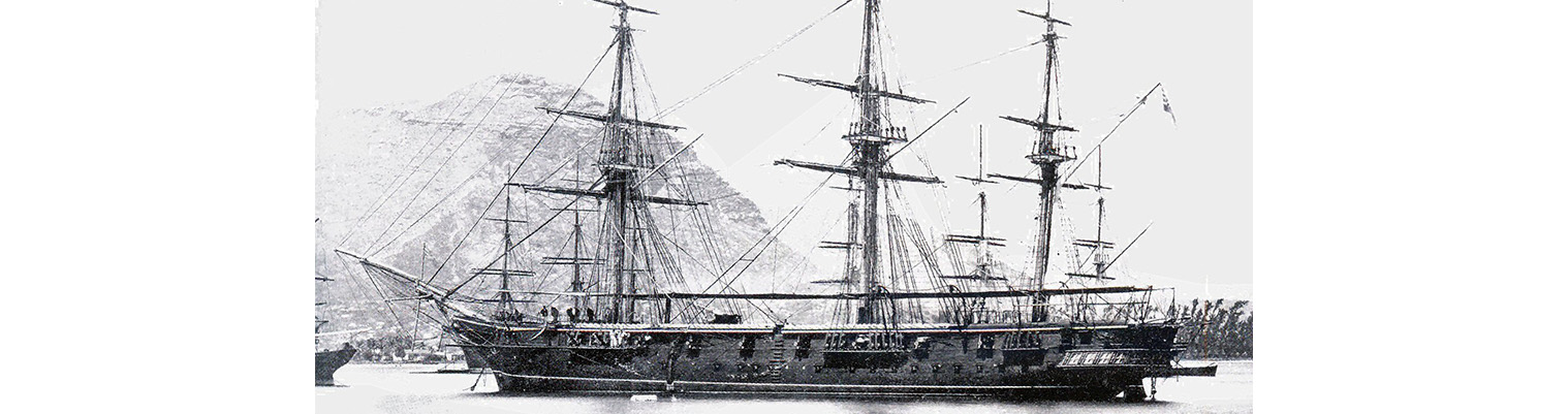
Year by Year
Discover the history of the HMS Cossack from 1854 to 1875.
You can search the ‘year’ and ‘month’ to find a specific date and also ‘click’ on the date itself to reveal any images and moments from that date.
16 August 1871
.Latitude 34.9S. Longitude 25.54E. Wind NE force 3 to 4 becoming light and variable. Under sail and stream 1700 anchored off Port Elizabeth. Algoa Bay. Barometer 30.20 inches. Course w by N.
0430 Commenced steaming. Observed a sail west.
0700. Observed land from N by E to west.
0815. Shortened sail and furled square sails. Course NW.
1200 land on starboard bow. Light house bearing N55W 12 nautical miles away but owing to the misty state of the atmosphere and the mirage we could not make out the land until 1515 when the light house was sighted.. About the same time the Island of St Croic and Jahiel were seen on the starboard bow and the houses of Port Elizabeth on the hill.
1700. Came to with sandy bottom in 7 fathoms and veered to 45 fathoms. Mended and furled sails. Anchor bearings. Fort Frederick W ½ S. Beacon Point S12E.
Remarks
During our passage we have had variable currents – not for two days together setting in the same direction except for the last two days when we were in the limits of the Agulhas current within 150 miles of the shore. We passes 2 or 3 sail on the way to the Cape. Numerous birds were generally hovering about the ship; chiefly Cape pigeons and albatross. Owing to the strong mirage on making the Bay were once or twice deceived as the appearance of the land and then we did not see the light until 15 when it bore SW 1/2W at the distance of about 6 nautical miles. The marks for Dispatch or Roman rock are the Red beacons and Light house in one ( Red and white) and two red and white square beacons with balls to the southward of Beacon Point, but on coming in we di not see the inner beacon owing to our looking for it along the shore as shown by the chart. Instead of which it is situated 1200 yards on higher land instead. The Port Elizabeth light is situated on the hill close to Donkin Monument and shows a fixed white light visible 12 nautical miles. From the balcony of the light house. The Time Ball is dropped at 1300 Cape mean Time corresponding to 1 hour 28 minutes mean time at this place. If failing it will be hoisted 8 minutes later. Latitude of lighthouse 33057’ -45S Longitude of lighthouse.250 37’-16E
Up to the 14th they had had a succession of westerly gales and during our stay we had light winds from the southward and eastward with a slight swell.
Coal lighters are large half-decked boats carrying about 12 to 18 tons which are loaded from the shore abreast the store houses and haul off through the surf. The stone breakwater is blocked up with sand and they are now trying to clear it but it is almost useless as the sea washes it in. they were sometime getting coal off owing to the heavy surf. some ws brought down already on the jetty and we received our first coal on the afternoon of the 17th taking in about 60 tons at the high price of £4 per ton.
19 August 1871
Latitude 34.53S. Longitude 22.54E. Course S71W. Wind NE force 3 becoming NW by W force 6. Under sail and steam.
0200. Altered course to WNW. Barometer falling – 30.00 inches. Wind E by N hauling of to the northward.
0620 Extreme of land NE by E ½ E. Cocks comet NE.
0645. Altered course to NW by W. Jib pendant stranded. Noon. Barometer 29.02 inches. Wind northerly force 3. Cloud bank gathered to the westward and in about half an hour the wind sprang up from the WNW increasing in force. Shortened and furled square sail. Bore up for Mossel Bay N ½ W.
1750. Observed land bearing north. Course NW.
1900. Sounded in 55 Fathoms ( Sand) . wind moderating. Altered course to W by N.
2100. Sounded in 44 fathoms ( find dark sand).
2300 sighted Cape St Blaize orth. Altered course to west .
Midnight. Cape Blaize N by E. light airs form northward.
21 August 1871
Latitude 35.4E. Longitude 19.50E. Course S79W. Wind NW by N force 6 to 8 becoming NW force 4. Barometer 30.19 inches. Maximum temperature 59F.
0300. Agulhas light bore E by N ¾ N. Wind strong from NNW. Barometer 29.86 inches and steady. Wind freshening with heavy sea.
0900. Wore and stood NNE. Wind NW by N force 6 to 8.
1200. Bore up for Strungs Bay. Shaped course ENE.
1230 Sighted land ahead.
1330 Agulhas Light House NE. . the lighthouse is 100 feet high and painted red and white; showing a white light with visibility of 18 nautical miles. Northumberland Point is low and sandy with scattered bushes. The large store house with flagstaff was seen over the point.
1545. Stopped and came to with sandy bottom in 7 fathoms and veered to 42 fathoms. Down Top gallant masts. At anchor in Strungs Bay. Anchorage bearings Northumberland point S50W. White House S85W. Light airs from the northwards. This bay affords a good anchorage for vessels during westerly gales but to the southward of WSW it is not safe. As few fishermen live here the nearest town with a telegraph office s a t the distance of 30 miles. A boats crew of fishermen came off to the ship and said that they expected a south easterly wind in a short time as it is generally sets in soon after the westerly winds fall light.
22 August 1871
Latitude 34.55S. Longitude 19.45E. Course West 12. Wind north easterly force 3 becoming WNW force 3. Under steam and sail. Barometer 30.20 inches. Cape of Good Hope N62W 71 nautical miles.
0800. Weighed and proceeded under steam. Wind east force 3.
1030 Cape Agulhas light House bore NE by N 5 miles. Shaped curse NW by W. swell from the westward.
Noon. Gunners Quoin N ½ W.
1315. Course NW by N.
1600. Danger Point NE by N.
1800. Cape Handklip N ¼ E. Course NNW. Observed Cape Light NNW.
2130. Overserved Roman Rock Light to north. Altered course to north.
2210. In Fore and Aft sails.
2300. Roman Rock Light N ½ W.
2340 Came to with sandy bottom in 10 fathoms and veered to 30 fathoms in Simons Bay. Bearings. Roman rocks light E by S ½ S. found here HM Ships RATTLESNAKE, ICARUS, GLASGOW and SERINGAPATAM.
23 August 1871
Wind NW 3 becoming N force 3. Barometer 29.91 inches.
0620. Up top gallant masts.
0800. Saluted the Broad Pennant of Commodore Commerell with 9 guns. Weighed and shifted berth under steam and took in dockyard. mooring.
1000. Loosed sail. Out boats.
1315. Furled sails. Employed getting up stores for survey.
1630. HMS GLASGOW sailed for Zanzibar and Trincomalee. Anchor bearings. Roman Rock light House S 78E. ; Dockyard flag staff S45W; Peak close to Handklip. S 41.10E .
Remarks
We left Algoa Bay with wind from ESE force 4. On nearing Cape Recife we appeared to be setting towards the reef which was breaking very heavily and certainly worth while giving a good berth as the current generally sets towards the point.
31 August 1871
Wind westerly force 2 becoming SW force 2.
Court assembled.
Remarks
About 1000 on the 19 August the barometer falling and wind hauling to the northward, there appeared signs of an approaching gale from the northwards and westwards by the cloudy and misty looking bank in that direction; rising fast and about noon it came on greatly. A little rain and wind force 6 to 8; the barometer having fallen gradually from Midnight (30.00 inches) to 27.79 inches at 1400. Altered course to Mossel Bay for about five hours but with the wind falling light we shaped course as before. During the next day the wind was from the N by W force 3 to 4 with the barometer at 29.90 inches with a beautiful clear sky.
On the 21st at about 0100 with Cape Agulhas Light about NE by E the wind again freshened from NNW in heavy squalls and little rain. Wind force 8 to 9. Barometer 29.84 inches.. At about noon the wind still holding good ( force 6 to 9) and making no headway by steaming against a very heavy sea we altered course to ENE for Strings Bay where on anchoring the wind fell light and the barometer began to steady. The next morning the breeze sprang up from the east and shifted to WNW during the afternoon.
Currents – Up to noon of the 19th we has a south westerly current of 30 nautical miles in 17 hours but the next two days an easterly set about 20 miles a day. On leaving Strings Bay no set was noticed… Being a clear night we sighted the Cape and Roman Rock Lights at full their distance and took the inshore passage up to Simons Bay.
Merchantmen occasionally come for water and coal in preference to Table Bay which of course is open to the westward gales occurring at this time of the year.
