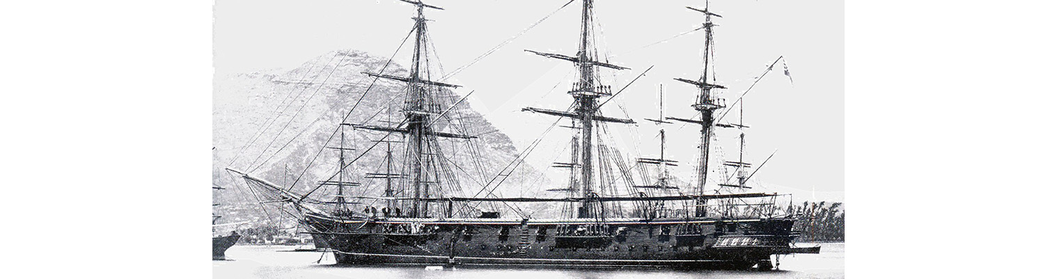
Year by Year
Discover the history of the HMS Cossack from 1854 to 1875.
You can search the ‘year’ and ‘month’ to find a specific date and also ‘click’ on the date itself to reveal any images and moments from that date.
23 September 1870
Wind SSE force 1 becoming easterly force 2 to 3. Barometer rising from 30.27 to 30.34. maximum temperature 79F.
1300. In boom boats. Pilot for Mahebourg came onboard.
1645. Brigadier general E. Smyth – Acting Consul – came onboard. The French mail steamer MOZAMBIQUE left harbour. Steamed out of harbour and saluted General Smyth with 13 guns.
1730. Proceeded round by the north to Mahebourg by steam.
1745. Assistant Harbour master left the ship. Set fore and aft sail.
2000. Cannonur Light SE. exercised at Night Quarters firing blank.
2140. Braced round, strong NE current.
2200 Lost sight of commoner Point Light S by W ½ W. Round Island NE, Gunners Quoin NNW, Flat Island and light NW by N ¼ N
24 September 1870
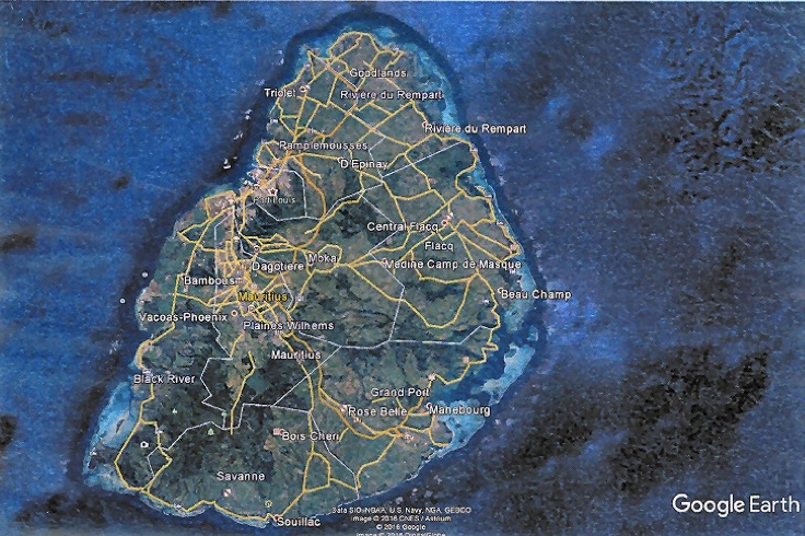
Wind easterly force 4 decreasing to 1. Barometer steady. 0730 Anchored off Mahebourg, Mauritius.
0020. Flat Island Light NW by N. altered course SE by S. 0330 altered course on observing Frouquits Light SW by S to S ½ W.
0515. Altered course to SW. 0530. Course W by S.
0645 Passed Frouquits Light House.
0745. Stopped and came to with sandy bottom in 6 ½ fathoms and veered to 3 shackles. Magnetic bearings Froquites Light House S74E – Point Chenilles S5W.
We entered by the southern channel which is the deepest of the three entrances. In entering and leaving the port you can pass very close to Isle Passe as there is plenty of water but on the other side the water breaks in about 7 fathoms in bad weather and therefore best to avoid it and keep to the Island side of the channel.
The harbour is surrounded with reefs for a great distance outside and rather resembles Victoria harbour Seychelles. There were more formerly buoys and beacons to mark the channel but they have been washed away and not replaced. On one reef there is an iron rod with a piece of brook lashed to it. This marks the Litte Pattie and in or two other places they have the same sort of mark. Makebourg is the HQ of of the XXth Regiment stationed at the Mauritius. There are no forts appears to be left entirely to the land forces.. Saluted the Governor General with 13 guns.
Directions for leaving the anchorage.
On leaving keep two factory chimneys (just to the right of the town) bearing west until abreast of Little Pate then keep a point to the north (E by N) factory chimney’s under Lions Head. NNW. Altered course to E by S with Red cliff kept about ENE. Chimmellis Point bearing SW alter course to SSE and S by E until abreast of Island de Passe and then to clear a shoal of 7 fathoms which sometimes breaks keep to the east about SE by E Light House on Frouquits Island. Bare north when clear of of this shoal
27 September 1870
Wind easterly force 2 to 3 increasing to 4. Barometer falling from 30.30 inches to 30.20 inches. Maximum temperature 73F.
0840. Pilot came onboard.
0900 Proceeded by steam and sail. Pointed yards to wind.0945. Frouquite Light N ½ W.
1015. Course SW by S. Made all plain sail. 100 Point Souffleur WNW. Bamboo Peak NE ½ N. course W ¾ N.
1600. Cape Brabant SE by S 4 miles. Shortened and furled sails. Lowered cutters and dropped a target and steamed round it firing shell and case. Passed a French Barque she evidently fancied we were going to take her as she squared her main yard. This part of the coast is covered with sugar estates and private houses, the entrance to Black River and Tamarin River could be distinctly seen by the old fashioned formerly towns defending them. Picked up target and proceeded NNE.
1955. Observed Belle Buoy Light E by N ½ E.
1940. Course NE by E.
1950. Altered course for Light. E by N ½ N.
2000. Flat Island Light NE by ½ E and Belle Buoy Light E by N.
2000 Came to in 15 fathoms and veered to 36 fathoms. Magnetic bearings Belle Buoy Light east I mile – Flat Island Light NE ¾ N
28 September 1870
Drew fires forward. Assistant Harbour master came onboard. Shifted under steam to Navy moorings up the harbour.
Your head and stern moorings are always prepared by a lighter therefore all you have to do is pass out two hawsers and heave them in but merchantmen have to anchor with their own anchors ahead and one astern in the hurricane months up the right hand side of the harbour. Moorings are found for them and they are moored in tiers of 3 to 6 vessels in each and never allowed to go up or down the river unless in charge of a pilot. Water to be had by applying to the control Department. They send it off in water tanks. The Quarantine Regulations are very strictly kept and the coolie ships arriving from India invariably have to undergo a fortnight or three weeks quarantine. Guard being kept in boat to prevent any communication with the shore. There are three large buoys (Iron. Red) especially for the of mail steamers just abreast of the Navy moorings. The sea breeze or SE wind generally sets in about 0900 – very light and occasionally varies to the north or NW and falling calm at night leaving a heavy damp.
05 October 1870
Wind south easterly force 1 to 3. Exercised at General Quarters. Preparing for sea. Draught of water aft 17 feet 10 inches. Forward 16 feet 8 inches. In boom boats.
1635. Assistant Harbour Master came onboard.
1730 . Slipped moorings and proceeded out of harbour under steam with mails onboard for Tamatare .
1735 Shaped course NW by W ½ W. Assistant harbour master left the ship. Made all plain sail accept Royals and Forward jib. Hove –to and sent mails on board Englis Barque HOPEFUL.
1845 altered course WSW under Topsails, foresail and Head sails. Stood off the island during the night – under sail.
